Subject: Cartographic Miscellany, Globe
Period: 1648 (published)
Publication: Parallela Geographiae Veteris et Novae
Color: Black & White
Size:
8.1 x 5.6 inches
20.6 x 14.2 cm
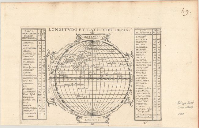
This globe shows the longitude and latitude of the key cities in the eastern hemisphere, from Dublin to the Cape of Good Hope to Macau. The location of each city is shown on the globe without any additional geographic information; there are no outlines of continents or countries. The cities along with their coordinates are then listed alphabetically in the tables flanking the globe.
References: Pastoureau, BRIET I [5]; Rumsey #12063; Shirley (BL Atlases) T.BRIE-1a.
Condition: A
On a bright sheet, trimmed just outside the platemark and pasted onto another sheet of hand laid paper with an old manuscript ink page number at top right. Light toning and soiling along the top edge of the sheet.