Catalog Archive
Auction 186, Lot 584

"Les Estats de l'Eglise, et de Toscane", Fer, Nicolas de

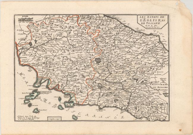
Subject: Central Italy

Period: 1702 (dated)

Publication: L'Atlas Curieux ou le Monde…

Color: Hand Color

Size:
13.3 x 9.1 inches
33.8 x 23.1 cm
Download High Resolution Image
(or just click on image to launch the Zoom viewer)

An attractive map of the Tuscany region including the cities of Florence, Livorno and Piombino. The map extends to include Rome to the south and San Marino to the northeast, and is filled with villages and towns, rivers, lakes, and mountains in profile. Engraved by Charles Inselin.

References: Pastoureau, FER I [95].

Condition: A

On a clean sheet of watermarked paper with a light dampstain and edge chip confined to the right margin.

Estimate: $160 - $190

Sold for: $120

Closed on 2/9/2022

Archived