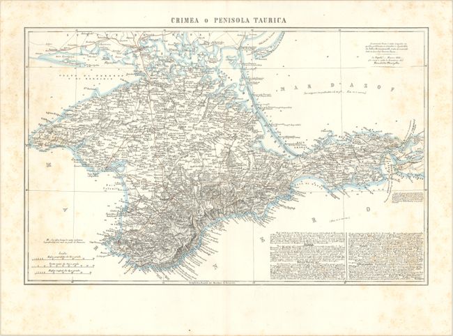
Subject: Crimea
Period: 1855 (dated)
Publication:
Color: Hand Color
Size:
23.6 x 15 inches
59.9 x 38.1 cm
Published during the Crimean War (1853-56), this detailed Italian map covers the peninsula in impressive detail. It includes intricate topographical detail, plenty of place names, roads, depth soundings, and notes in Italian providing information on the region. A note at top right credits John Arrowsmith's map of 1854 as the source.
The Crimean War pitted Russia against an alliance of France, the Ottoman Empire, Britain, and Sardinia in a fight for influence over territories of the declining Ottoman Empire, stemming in part from a conflict between the Russian Orthodox and Roman Catholic churches in the Holy Land. Russia lost the war and, as a result, much of their influence in the region.
References:
Condition: B+
Contemporary outline color with light scattered foxing.