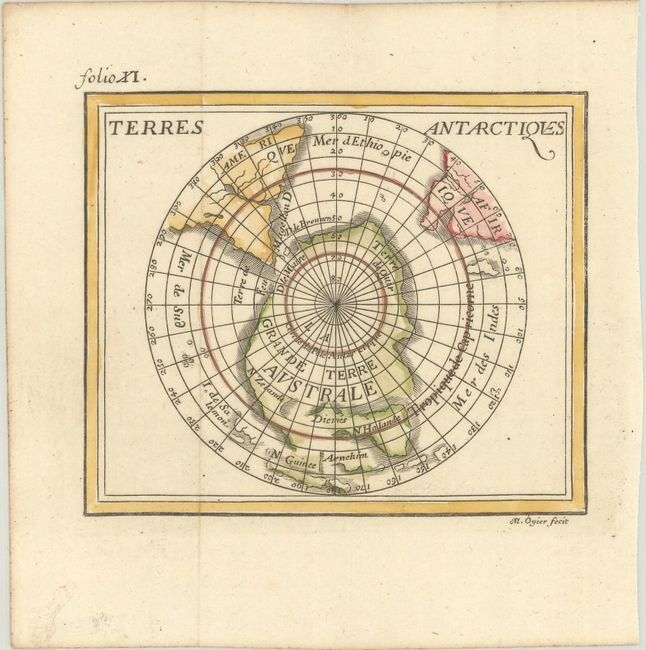
Subject: South Pole
Period: 1688 (published)
Publication: La Geographie Universelle
Color: Hand Color
Size:
4.6 x 3.9 inches
11.7 x 9.9 cm
Finely engraved miniature map of the South Pole, showing a large Terre Australe, which appears to be connected to New Zealand. Australia and Tasmania are depicted with conjectural coastlines, leaving uncertainty as to whether or not they are connected. This is a newly engraved plate that closely follows the original, first published in 1661, however some changes have been made. Most notably, it bears the engraver's signature (R. M. Ogier) at bottom and much of the regional nomenclature has been omitted. Published by Jean Certe in Lyons for Duval.
Pierre Duval was Nicolas Sanson's nephew and pupil. He published a wide range of atlases and individual maps including a fine miniature world geography with many of the maps based on Sanson.
References: King (2nd ed.) pp. 132-135; Pastoureau, Duval XI H [3].
Condition: A
A crisp impression on a bright sheet, issued folding with light toning along the edges of the sheet.