Subject: Southern Germany
Period: 1704 (circa)
Publication: Variae Tabulae Geographicae in Quibus Loca in Orbe Bello...
Color: Hand Color
Size:
18.6 x 14.8 inches
47.2 x 37.6 cm
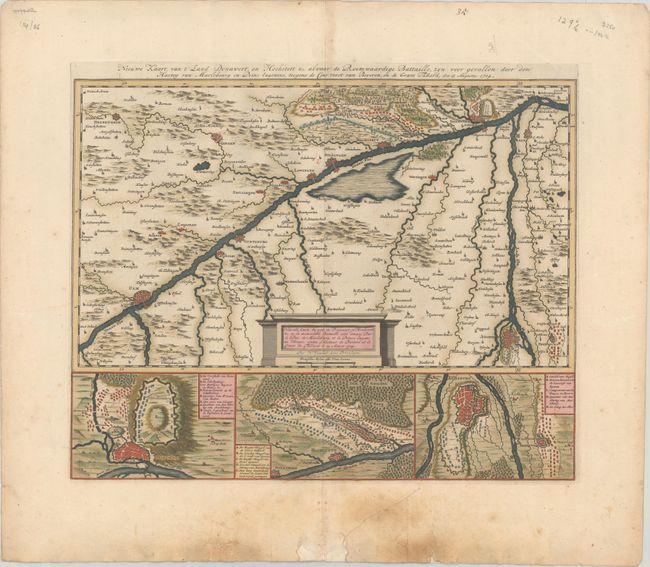
This detailed map shows the region between Ulm, Donauworth, and Augsburg. The map illustrates an important battlefield during the War of the Spanish Succession. The Duke of Marlborough, marching from Flanders to Bavaria, approached the Danube with 35,000 men. The French had 64,000 men in the vicinity of the river, with 10,000 of them on the Schellenberg, a hill above Donauworth that commanded the river crossing. Much to the surprise of the French, Marlborough launched a successful attack on the hill, captured Donauworth without a siege, and crossed the Danube without further incident. Three insets provide detailed views of the fortifications and troop placements at Donauworth, Hochstett, and Augsburg. Title cartouche with French title, with Dutch title above border.
References: Phillips (Atlases) #3387-19.
Condition: B+
A crisp impression with contemporary color on a watermarked sheet with soiling in the bottom margin. There are a few chips and tears in the bottom blank margin that have been partially repaired with old paper.