Subject: North Pole
Period: 1850 (published)
Publication:
Color: Black & White
Size:
24.3 x 24.1 inches
61.7 x 61.2 cm
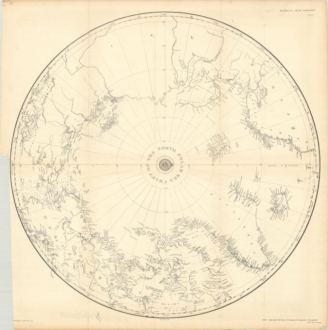
This circumpolar map presents the Arctic explorations to date including those of Parry, Franklin, Hearne, MacKenzie, and more. Near Banks Land in northern Canada is the notation "Loom of the Land," where Captain Parry erroneously thought he had spotted land. Further to the west, there is good detail in the waters around the Behring Strait including numerous depth soundings and several notations of "packed ice" and the "appearance of land" to the north of the strait. To the east, the southern coastline of Nova Zembla is still speculative, and the tracks of Lieutenant Pyotr Anjou are located near the New Siberian Islands. Decorated by the seal of the British Hydrographic Office at center. This chart was corrected to 1849 and "ordered by the House of Commons to be printed 5 March, 1850."
References:
Condition: B+
Issued folding and now flattened and backed with tissue. There is a small chip along a lower fold and an archivally repaired binding tear at left that just touches the border. A couple of long cracks are confined to the bottom blank margin.