Subject: North Pole
Period: 1740 (circa)
Publication: Atlante Novissimo...
Color: Black & White
Size:
12.6 x 10.7 inches
32 x 27.2 cm
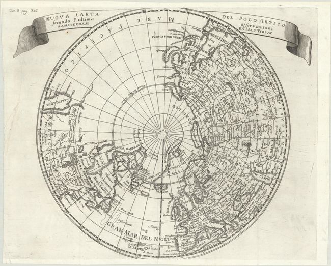
This north polar projection includes the northern part of the island of California with the Pacific region left completely blank. There is good detail in Europe and Asia, with even the Great Wall of China shown, while relatively little detail appears in North America. The Mississippi River extends west and connects with a large lake, Gnacsitares, that almost reaches the West Coast, based on the embellished account of Baron de Lahontan. Quivira and Santa Fe are also noted in the west. Greenland is connected to both the North Pole and Canada. Ribbon style title cartouche. Kershaw attributes this map to Delisle.
References: cf. Kershaw #416; McLaughlin #216-2.
Condition: B+
A nice impression issued folding, now flat, with a professionally repaired 4" tear in an unengraved area at left.