Subject: North Pole
Period: 1676 (published)
Publication: Nieuwe en beknopte Uytbeeldinghe…
Color: Hand Color
Size:
9.6 x 7.1 inches
24.4 x 18 cm
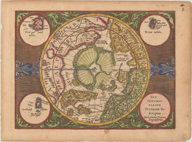
This reduced version of Mercator's famous map of the North Pole was originally published in the Atlas Minor by Johannes Cloppenburg and was most likely engraved by Pieter van den Keere. The hemisphere is surrounded by a finely engraved design with four round insets in each corner. These contain the title, the Faeroe Isles, the Shetland Isles, and the mythical island of Frislandt. The North Pole is shown according to legend as a large rock in a giant whirlpool surrounded by four islands that are separated by rivers. The magnetic pole is depicted as an island in the Strait of Anian. An elaborate river network and large bay is shown in the extreme northwest part of North America. Blank verso.
References: Burden #225; Kershaw #32; Van der Krogt (Vol. III) #0020:353A.2.
Condition: B+
Lightly toned with a couple of spots in margins.