Subject: Guyana, Suriname, French Guiana
Period: 1783 (dated)
Publication: General Atlas
Color: Hand Color
Size:
26.7 x 20.1 inches
67.8 x 51.1 cm
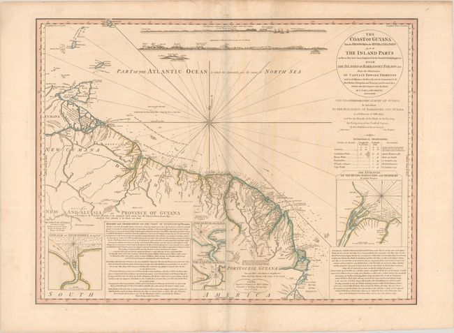
This detailed map gives good information both on land and at sea. The extensive river systems are all named, as well as a number of mountains. Notes on natives and settlements are included, as well as a notation on the Golden Lake of Parima and the Imaginary City of Manoa del Dorado. The coastline is filled with soundings, the flow of currents, and several land approach views at top. Four inset maps depict the entrances to the rivers Essequibo, Berbice, Suriname, and Cayenne. William Faden published this chart after he succeeded Thomas Jefferys as Geographer to the King in 1771. In his role, Faden had an advantage over other publishers due to his access to government material which was not generally available to his competitors. A very handsome chart that is not often seen.
References:
Condition: B+
Contemporary color on paper with an "1802" watermark, light foxing, several extraneous creases, and a faint damp stain along the centerfold.