Subject: Central Virginia, Civil War
Period: 1865 (dated)
Publication: Report of Chief Engineer U.S.A., 39th Congress, 1st Session
Color: Hand Color
Size:
24.1 x 32.6 inches
61.2 x 82.8 cm
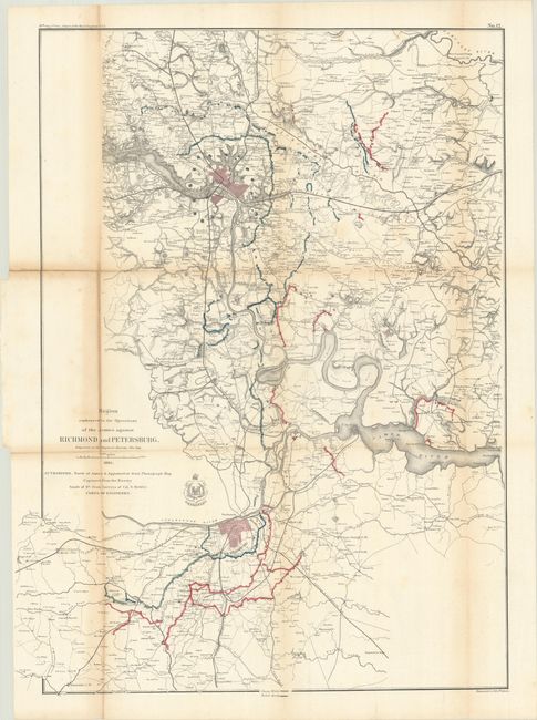
This large folding Civil War map is dated 1865 but was published in the Chief Engineer's report of 1866. The map depicts the military positions of the Union and Rebel armies in red and blue in the vicinity of Richmond and Petersburg. Information includes roads, villages, railroads, watershed and the terrain in hachure. The coat-of-arms for the Army Corps of Engineers is below the title. This map is plate No. 12 from the report and is drawn on a scale of 0.75 miles per inch. It is an early published Civil War map; most reports and maps withheld publication until the 1890's to allow time for the national wound to heal sufficiently for a public discussion of the conflict.
References: Stephenson (Civil War) #644.
Condition: B
Issued folding and now flattened and backed with tissue to reinforce and repair a few small fold separations. There is light toning along the folds which is more prominent at left along with some minor staining.