Subject: Northern Texas & Oklahoma
Period: 1949 (dated)
Publication:
Color: Printed Color
Size:
33.9 x 21.9 inches
86.1 x 55.6 cm
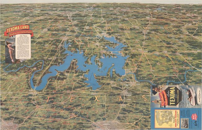
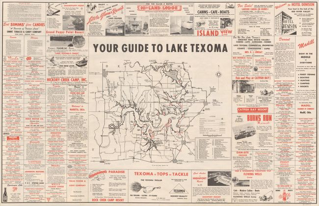
This promotional bird's-eye view of Lake Texoma along the Texas/Oklahoma border was published by the Lake Texoma Sportsman Club. Lake Texoma and the Denison Dam were established in 1938 to mitigate against the annual flooding of the Red River. Upon completion in 1944, the lake was marketed for recreational purposes and touted as the "largest body of water between the Canadian border and the Gulf of Mexico," covering 227 square miles and 1,250 miles of coastline. The map extends north to Tulsa and Oklahoma City and south to the Dallas/Fort Worth region, demonstrating both proximity and ease of access from urban areas. The verso features a highway map of the vicinity surrounded by numerous local advertisements. Lithographed by MWM Color Press in Aurora, MO. Self-folding into pictorial wrappers (3.7 x 8.5"). We found no past sales records and only three institutional examples on OCLC (Texas Tech, Texas A&M, and UT-Arlington).
References:
Condition: B+
A clean and colorful example with two 3.5" fold separations that have been closed on verso with archival tape. Issued folding.