Subject: Central Michigan
Period: 1889 (dated)
Publication:
Color: Printed Color
Size:
12.9 x 25.9 inches
32.8 x 65.8 cm
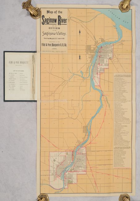
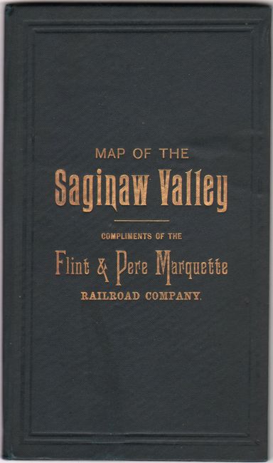
This scarce map covering the Saginaw River was drawn by A.J. Wenzell and published by the Flint & Pere Marquette Railroad Company. Issued around the height of the area's lumber boom, It depicts the street grid pattern of both Saginaw and Bay City with the company's railroad lines shown in red overprinting. A table at right lists the numerous lumber yards, mills, and other industries situated along the Flint & Pere Marquette line, demonstrating its favorable position for commerce. Folds into black cloth boards (4.0 x 7.0") with gilt title on the front cover. We found only one other auction record in the last 30 years, and three institutional examples located on OCLC.
References:
Condition: B+
Issued folding with a number of fold separations that have been archivally closed on verso along with two repairs to fold separations on recto at left. Covers are near fine.