Subject: World
Period: 1787 (dated)
Publication:
Color: Black & White
Size:
19.7 x 10.2 inches
50 x 25.9 cm
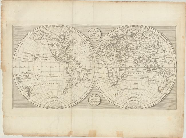
This attractive double-hemisphere world map shows the latest discoveries of Captain James Cook. Alaska is presented with a fairly accurate shape, and the Sandwich Islands are shown and noted as the place where Capt. Cook was killed. In North America, the United States' boundary is along the Mississippi River with Louisiana and New Mexico to its west. In the Pacific Northwest, a River of the West is shown connecting Lake Winnipeg to the Pacific Ocean. The South Pacific is filled with islands, New Zealand is fully formed, but Tasmania is still attached to Australia.
References:
Condition: B+
A crisp impression with an extraneous crease adjacent to the left fold. There are a number of small edge chips and tears far from the image that have been archivally repaired with tissue on verso. Old tape has been mostly removed from the verso along the bottom sheet edge with some staining on recto.