Subject: San Francisco, California
Period: 1950 (circa)
Publication:
Color: Printed Color
Size:
19.8 x 15.6 inches
50.3 x 39.6 cm
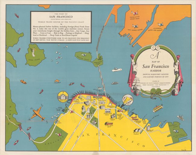
This scarce and charming pictorial map of San Francisco Harbor was designed by Philip Little. Issued by the Board of State Harbor Commissioners, the map celebrates the port of San Francisco as the "World Trade Center of the Pacific Coast," noting in a text box at top left that "[m]aster-planned harbor facilities, including Foreign (Free) Trade Zone No. 3, make this one of the world's great maritime centers." It highlights the World War II-era military development in the region, indicating Naval areas such as the Alameda Naval Air Station with goats and Army areas such as the Oakland Army Base with mules. The map features illustrations of many sites of interest in the area, including the Golden Gate and San Francisco - Oakland Bay bridges, the Ferry Building, Coit Tower, the Civic Center, Union Square, and more. Angel, Treasure, and Yerba Buena islands are all located. An airplane serves as the compass rose. The decorative title cartouche is a throwback to an earlier era of mapping, with a nautical theme and strapwork detailing. Backed with linen.
References:
Condition: A
Issued folding, now flat and backed with linen.