Subject: Yosemite Valley, California
Period: 1946 (dated)
Publication:
Color: Black & White
Size:
19 x 13.5 inches
48.3 x 34.3 cm
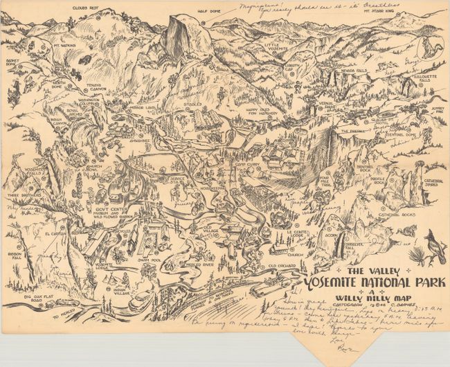
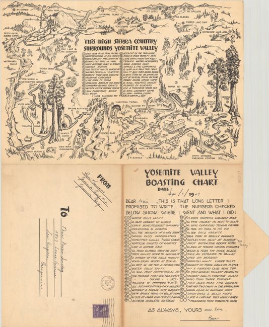
This souvenir cartograph is self-mailing and could be sent to a loved one to share an overview of one's trip to Yosemite National Park. The page unfolds to show a three-dimensional map of Yosemite Valley with images of all the sites and activities one might hope to experience, including Half Dome, Yosemite Falls, El Capitan, Camp Curry, and the stables. Locations are numbered and listed on verso within a "Yosemite Valley Boasting Chart" that allows you to mark which sites and activities you completed during your visit. Also on verso is a second map highlighting the region surrounding Yosemite Valley with additional sites noted. The cartograph was created by C. Barnes and published by the Willy Nilly Map Company, which also produced self-mailing maps of several other national parks.
This example was filled out by a tourist staying in Yosemite Camp #12 on 7 September 1947 (whose name is indecipherable) and mailed to a friend in Los Angeles, California. She adds charming notes within the map, such as "nice people" at Camp Curry, "don't try it" adjacent to Four Mile Trail, and even named images of a hare and a coyote "Nell" and "George."
References: Rumsey #11256.
Condition: B+
Issued folding with one short fold separation, light soiling, and numerous old ink notations.