Subject: Arkansas
Period: 1841-95 (dated)
Publication:
Color:
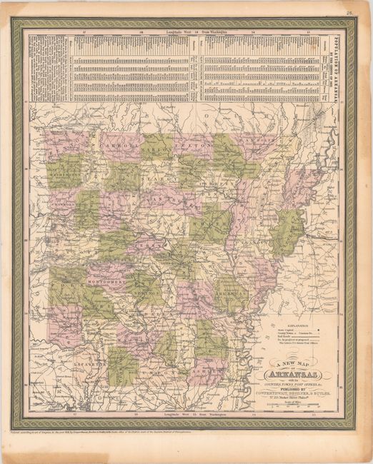
A. A New Map of Arkansas with its Counties, Towns, Post Offices, &c., by Cowperthwait, Desilver & Butler, from A New Universal Atlas…, dated 1855, hand color (12.7 x 15.1"). This attractive and early map of Arkansas shows county lines current to 1852 with the newly organized Columbia County in the southwestern part of the state. The map names many towns and post offices, and a number of roads and railroads are depicted. Several proposed railroads are delineated as well. Above the map are population statistics by county from the 1850 Census. This is the first year that Desilver and Butler joined Cowperthwait as publishers. Condition: Contemporary color with a few inconspicuous spots within map and some stains in blank margins. A short archivally repaired tear just enters the border in the top right corner. (B+)
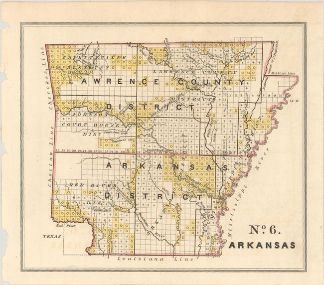
B. No. 6 Arkansas, by U.S. Government, from Report of the Secretary of the Treasury, 26th Congress, 2nd Session, published 1841, hand color (8.5 x 7.4"). This interesting little map divides Arkansas into land districts. It was issued to illustrate the status of public lands during the debate on the Preemption Act of 1841, which granted squatters who were living on federal land to purchase up to 160 acres for $1.25 per acre. Condition: Faint offsetting, otherwise fine. (A)
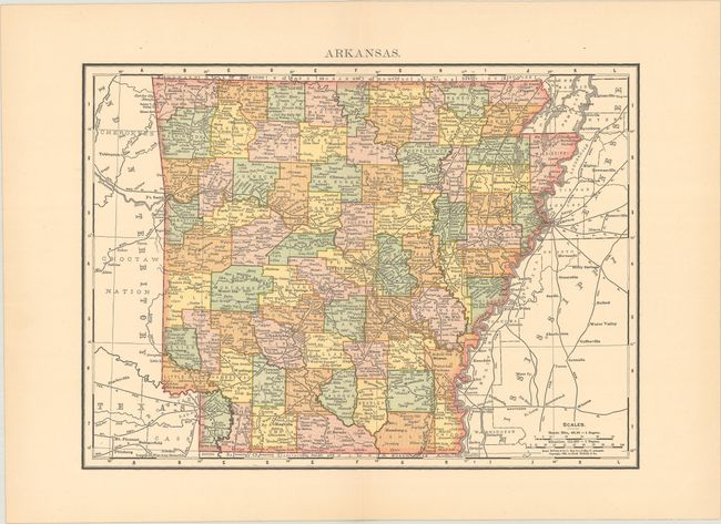
C. Arkansas, by Rand, McNally & Co., dated 1895, printed color (12.6 x 9.2"). An up-to-date country map showing recent boundary changes in Scott and Sebastian counties. Condition: Near fine. (A)
References:
Condition:
See description above.