Subject: New York, New Jersey, Connecticut, & Pennsylvania
Period: 1838 (dated)
Publication: A General Atlas of the World
Color: Hand Color
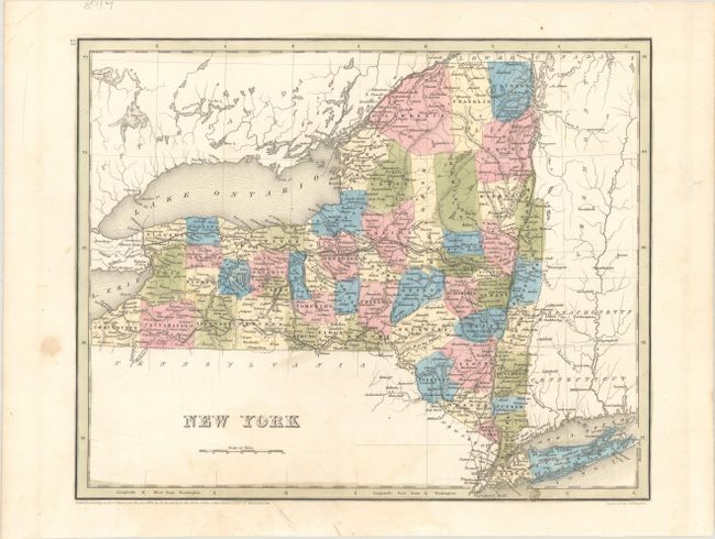
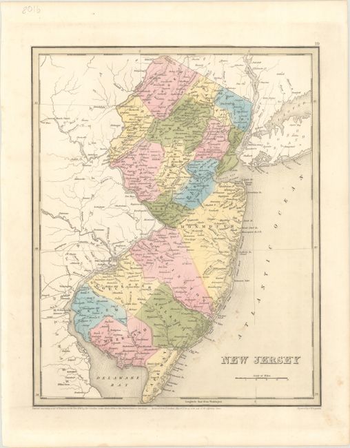
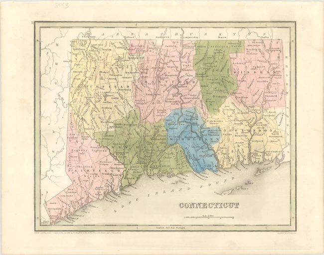
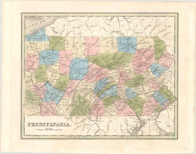
An attractive set of maps issued in Bradford's A General Atlas of the World. Larger and more detailed than Bradford's Comprehensive Atlas, each state map identifies counties, county seats, canals, wagon roads, early railroads, and more. All four were engraved by G.W. Boynton.
A. New York (14.1 x 11.4"). Despite the 1838 copyright date, Wyoming County, officially established in 1841, is delineated in the western part of the state.
B. New Jersey (11.4 x 14.1"). This map was reduced from Thomas Gordan's important map of New Jersey. County configuration extends beyond the 1838 copyright date to include Mercer and Hudson counties, established in 1839 and 1840, respectively.
C. Connecticut (14.2 x 11.3"). County configuration is up to date.
D. Pennsylvania (14.2 x 11.4"). County development is current for 1838, just prior to the organization of Clinton and Clarion counties.
References:
Condition:
Nice impressions in contemporary color on clean, bright sheets. The Connecticut and Pennsylvania maps are in A condition. The New York and New Jersey maps are in B+ condition, with light spots in the map images.