Subject: Mid-Atlantic United States
Period: 1932 (dated)
Publication:
Color: Printed Color
Size:
32.3 x 6.3 inches
82 x 16 cm
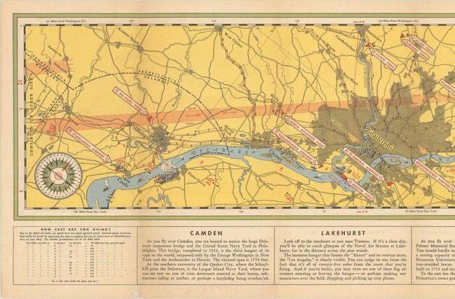
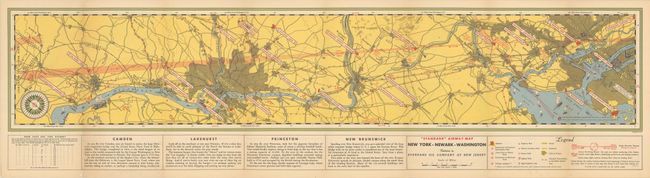
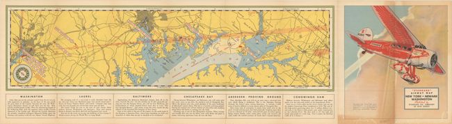
This strip map shows the air route between New York and Washington, DC, noting all of the airports and airfields in between. The long map is divided into two parts, with New York to Newark, Delaware on one side and Newark to DC on the other. The detailed legend notes other important features for pilots, such as lighted fields, railroads, and high explosive areas. Additional navigational notes are included below the map. The cover features a Stanavo monoplane. Published by Standard Oil Company of New Jersey.
References:
Condition: B+
Issued folding, with light toning and some small worm holes along the bottom edge of the sheet.