Subject: Rhode Island, Vermont, New Hampshire, & Maine
Period: 1838 (dated)
Publication: A General Atlas of the World
Color: Hand Color
Size:
11.4 x 14.1 inches
29 x 35.8 cm
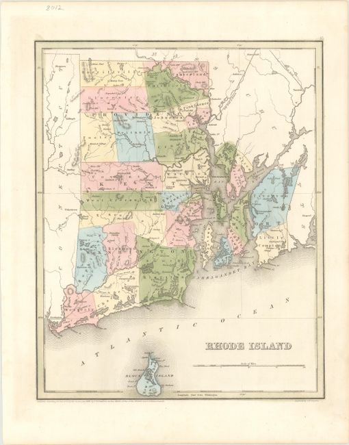
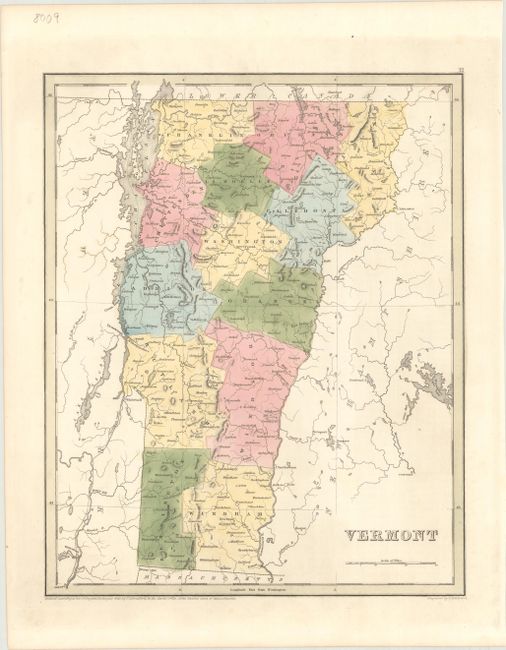
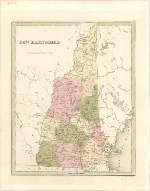
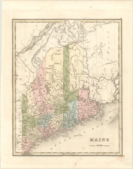
An attractive set of maps issued in Bradford's A General Atlas of the World. Larger and more detailed than Bradford's Comprehensive Atlas, each state map identifies counties, county seats, canals, wagon roads, early railroads, and more. All four were engraved by G.W. Boynton.
A. Rhode Island. The map depicts five counties: Providence, Kent, Washington, Bristol, and Newport. It locates two railroads, Stonington Rail Road and Rail Road to Boston, and extends to include Block Island.
B. Vermont. County configuration is up to date with the inclusion of La Moelle (Lamoille).
C. New Hampshire. Although the copyright date is 1838, the map includes three counties organized in 1840: Carroll, Belknap, and Strafford.
D. Maine. County configuration is current to 1839 (despite the 1838 copyright date), with the recent additions of Franklin, Piscataquis, and Aroostook counties. There are a few interesting notations regarding the state's boundaries: "True Boundary According to the Treaty of 1783;" "Line as Proposed by the King of the Netherlands;" and, farther south, "Line Claimed by Great Britain."
References:
Condition:
Nice impressions in contemporary color on clean, bright sheets. All are in A condition, with the exception of the Maine map, which is in B+ condition due to light soiling.