Subject: New England United States
Period: 1836 (dated)
Publication:
Color: Hand Color
Size:
34.2 x 25.8 inches
86.9 x 65.5 cm
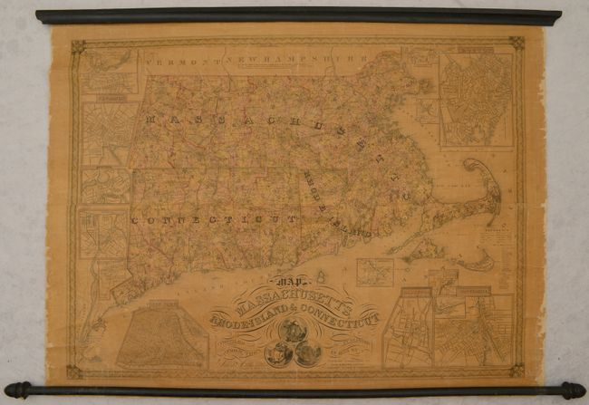
This detailed wall map of southern New England is delineated by county and locates canals, railroads, roads, and more. The mapmaker proudly notes: “This map in addition to the information found on the best maps, contains Factories, Churches, Academies, Banks &C…” In fact, some 1,244 factories are noted, many named, with a handy reference guide indicating the type of factory. The map features large inset maps of Boston, New York, New Haven, Salem, Lowell, Hartford, Providence, and five other small cities. Decorated by fancy titling and the state seals of the three states.
This map documents the early beginning of the Industrial Revolution in America in which New England was at the forefront, paving the way for America’s booming manufacturing economy in the 19th century.
References:
Condition: B+
There is uniform light toning with some minor cracks and abrasions in the image. Numerous small edge chips are confined to the blank margins. Rollers are present and intact.