Subject: North America, Franklin
Period: 1820 (circa)
Publication: Universal Atlas, for the Use of Schools...
Color: Hand Color
Size:
8.4 x 7.2 inches
21.3 x 18.3 cm
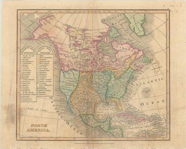
This scarce map of North America was published by John Bradley and presents the political divisions of the United States and Spanish Dominions shortly before Mexican Independence. The map is keyed to a legend at left and locates a large Georgia including the "Back Settlements," Western Territory, Louisiana Territory, and a late depiction of the short-lived state of Franklin. In 1785, settlers in western North Carolina and what would become eastern Tennessee organized a state government to be named in honor of Benjamin Franklin. Congress turned down their appeal, but the state maintained a legislature and governor until 1788. This ephemeral state appears on only a small number of maps, and this is the first example of the Bradley map that we have seen at Old World Auctions. We locate no prior sales records and only one institutional holding at the Newberry Library.
References: Dotson & Baker (OWA) #29.
Condition: B
There is some minor soiling and a small centerfold separation at bottom that has been closed on verso with archival tissue. Several thin paper cuts at lower right and in the left blank margin have been closed on verso with archival materials.