Subject: References, Africa
Period: 1969-97 (published)
Publication:
Color: Printed Color
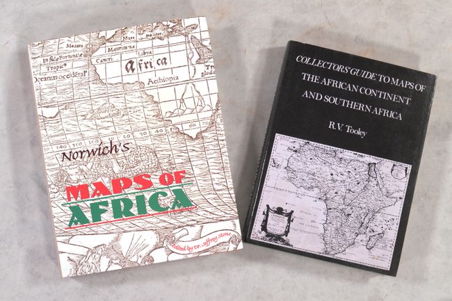
A. Collectors' Guide to Maps of the African Continent and Southern Africa, by R.V. Tooley, published 1969 (7.5 x 10.0"). This important reference identifies nearly 500 maps with more than 100 full-page illustrations, some of them in color. It covers both continental maps and maps of South Africa. 132 pp. plus 81 b&w plates at the end. Hardbound in red buckram, with gold embossed lettering on spine, and a light blue paper dust jacket. Scarce First Edition. Condition: Minor shelf wear and endpapers have light foxing.
B. Norwich's Maps of Africa - An Illustrated and Annotated Carto-Bibliography, by Oscar I. Norwich, published 1997 (8.8 x 11.3"). This great reference was written by one of the leading collectors of the maps of Africa. The book comprises an in-depth look at the continent from the beginning of the Age of Exploration to modern times. Both maps of the African continent as a whole, as well as regional maps of Africa are catalogued. Second edition, revised and edited by Jeffrey C. Stone. 408 pages filled with illustrations, some colored, covering 345 maps. Hardbound in red cloth with illustrated dust jacket. Condition: Dust jacket shows minor wear.
References:
Condition: A
See description above.