Subject: Northern Africa
Period: 1762-1850 (circa)
Publication:
Color: Hand Color
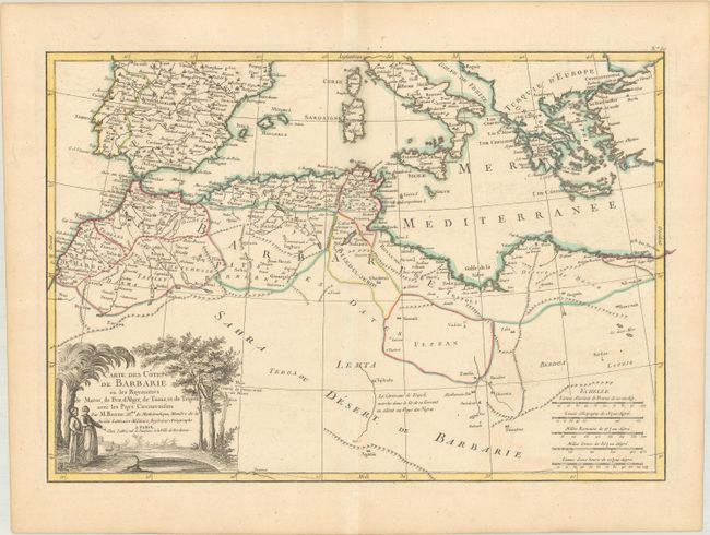
A. Carte des Cotes de Barbarie ou les Royaumes de Maroc, de Fez, d'Alger, de Tunis, et de Tripoli, avec les Pays Circonvoisins, by Bonne/Lattre, from Atlas Moderne, circa 1762 (17.4 x 12.1"). This attractive map focuses on the Barbary coast of Africa but extends to include much of the Mediterranean. It depicts portions of Morocco, Algeria, Libya, and Egypt. While the Sahara and much of the African interior are left blank, there is good detail and plenty of place names along the coast. The handsome title cartouche shows two Arab merchants at an oasis. Five distance scales appear at bottom right. Condition: A sharp impression with contemoprary outline color on watermarked paper with minor soiling.
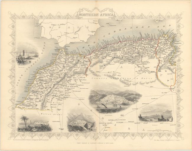
B. Northern Africa, by John Tallis, from Illustrated Atlas and Modern History of the World, circa 1850 (13.0 x 9.9"). This lovely steel engraved map features a decorative border and vignettes of Mogador (now called Essaouira), Morocco, Constantine, Algiers, and Tunis. Many caravan routes are shown in the Sahara Desert, north of which is noted as Country abounding in Dates. The maritime states of Tunis, Algiers, and Morocco comprise the region known during this period as the Barbary Coast. The illustrations were drawn by H. Winkles and engraved by G. Greatbach; the map was drawn and engraved by J. Rapkin. Condition: Contemporary outline color with some minor spots and faint toning along the centerfold.
References:
Condition: A
See description above.