Subject: Eastern China
Period: 1860 (dated)
Publication: Twelve Years in China...
Color: Hand Color
Size:
17.2 x 24.9 inches
43.7 x 63.2 cm
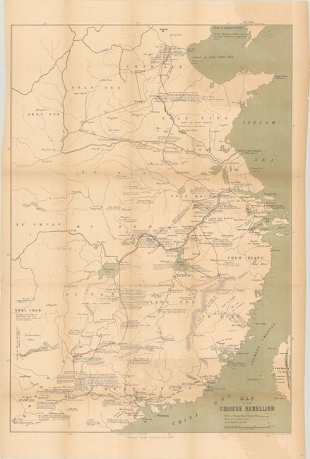
This map of eastern China was issued in Twelve Years in China... by John Scarth. It was published near the conclusion of the Second Opium War (1856-60), a battle between the Qing Dynasty and both Britain and France. Highly detailed, the map includes a legend at bottom right indicating the march of Taiping Wang's Troops (red lines), movements by other rebel groups (dashed black lines), and rebel districts (small red crosses). In addition to troop movements, the map is filled with interesting and descriptive notations including "The rebels held this place for two years against all opposition but at last the men killed the chief and surrendered." Britain and France ultimately prevailed with the signing of the Convention of Peking on October 24, 1860, garnering additional lands for Hong Kong and simplifying trade with China.
References:
Condition: B
Issued folding and now flattened and backed with tissue to reinforce and repair 2" and 4" tears at left. There is light toning and offsetting.