Subject: Aegean Sea
Period: 1817-45 (dated)
Publication:
Color: Hand Color
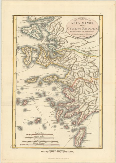
A. The Coasts of Asia Minor, from Cyme to Rhodes. For the Travels of Anacharsis, by Jean Denis Barbie du Bocage, dated 1817 (8.6 x 12.6"). This map shows Turkey's Aegean coast and nearby islands such as Chios, Lesbos, and Rhodes. It appeared in an imaginary travel journal chronicling the fictional journey of Anarcharsis the Younger through ancient Greece. There are four distance scales. The cartouche dates the map December 1799, but this example was published by J. Mawman in 1817 in a later English edition of Jean Jacques Barthelemy's Recueil de Cartes Geographiques Plans, Vues et Medailles de l'Ancienne Grece, Relatifs au Voyage du Jeune Anacharsis. Condition: Issued folding, now flat, with just a hint of offsetting. (A)
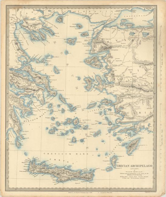
B. Grecian Archipelago (Ancient), by SDUK Society for the Diffusion of Useful Knowledge, dated 1845 (12.4 x 15.3"). This SDUK map centers on the Aegean Sea and extends to include the coasts of Greece and Turkey. There is nice topographical detail throughout. The various islands of the region are identified, including Crete. The map is credited to William Smith L.L.D. Engraved by J. & C. Walker. Published by Charles Knight & Co. Dated April 1st, 1843 in the publisher's imprint, corrected June 1st, 1845. Condition: There is some light dampstaining that just enters the border at top and light soiling that is mostly confined to the sheet's edges. (B+)
References:
Condition:
See description above.