Catalog Archive
Auction 185, Lot 524

"[Lot of 4] A Correct Map of the North West Part of Germany... [and] A Correct Map of the North East Part of Germany... [and] A Correct Map of the South East Part of Germany... [and] A New and Correct Map of the South West Part of Germany...", Bowen, Emanuel

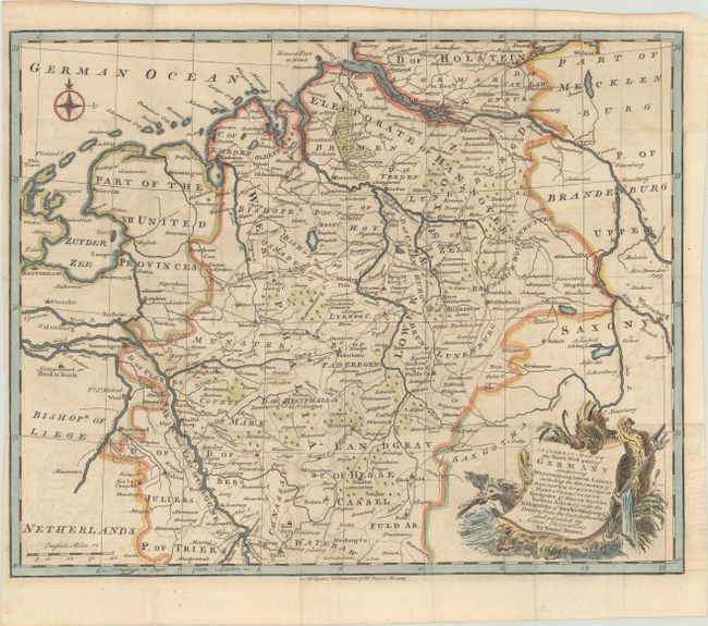
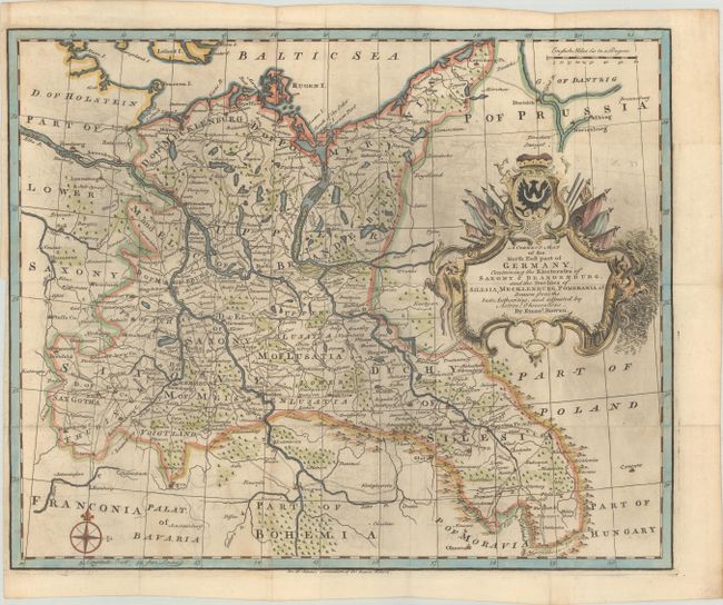
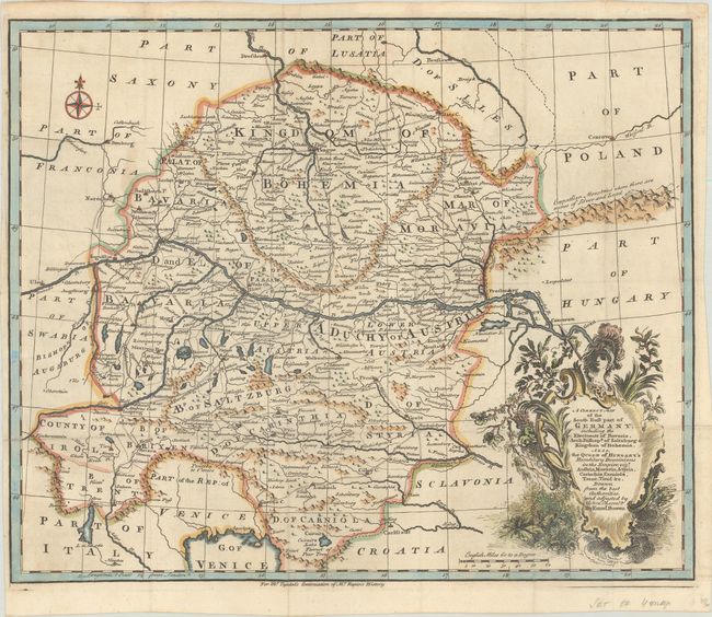
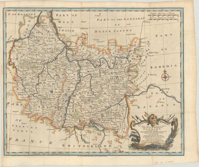
Subject: Central Europe, Germany

Period: 1740 (circa)

Publication: Mr. Tyndal's Continuation of Mr. Rapin's History

Color: Hand Color

Size:
16.8 x 13.5 inches
42.7 x 34.3 cm
Download High Resolution Image
(or just click on image to launch the Zoom viewer)

This is a complete, matching set of maps of Germany extending from the North Sea, to the Baltic Sea, to the Gulf of Venice. The maps are filled with details of cities, roads, political boundaries, rivers, and topography. Each map stands on its own with full borders and a decorative title cartouche.

References:

Condition: B+

The maps were issued folding and now flattened on sheets with a small fleur-de-lis watermark. There is minor soiling and offsetting, and the northeast sheet has printer's ink residue. The southwest sheet has a small piece of masking tape along the left edge of the sheet on verso, which has caused minor staining on recto.

Estimate: $350 - $425

Sold for: $250

Closed on 11/17/2021

Archived