Subject: Western Spain & San Lorenzo de El Escorial
Period: 1616-84 (circa)
Publication:
Color: Hand Color
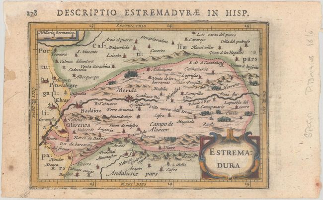
A. Estremadura, by Hondius/Bertius, from Tabularum Geographicarum Contractarum…, circa 1616 (5.4 x 3.8"). A charming miniature map of the Extremadura community in western Spain, centered on Merida. The map extends from Badajoz in the west to Caceres in the North. Adorned with a strapwork cartouche. The majority of the maps for Bertius' geographical treatise were engraved by Jodocus Hondius Jr. after Mercator. Latin text on verso, published in 1616 or 1618. References: King (2nd ed.) pp. 96-99; Van der Krogt (Vol. III) #6051:342. Condition: On watermarked paper with minor toning and marginal staining.
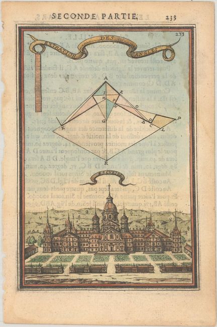
B. Extration des Angles - Escurial, by Alain Manesson Mallet, from Les Travaux de Mars, circa 1684 (3.8 x 5.6"). This handsome miniature engraving shows El Escorial, King Phillip II's monastery-palace built in the late 16th century. The massive structure occupies more than 40,000 square feet and has 12,000 windows and doors. Designed by the Spanish architect Juan Bautista de Toledo who had worked in Italy assisting Michelangelo at St. Peter's, it was built to commemorate the king's victory over the French at St. Quentin in 1577. The palace also contains the mausoleum of Philip's father, Charles V. A geometrical diagram and two banner cartouches float above the palace. Reference: Pastoureau, MANESSON-MALLET II B. Condition: There is a light dampstain that enters the engraved image at top right and some show-through of text on verso.
References:
Condition: B+
See description above.