Subject: Baltic
Period: 1680 (circa)
Publication: The English Atlas
Color: Hand Color
Size:
20.1 x 15.3 inches
51.1 x 38.9 cm
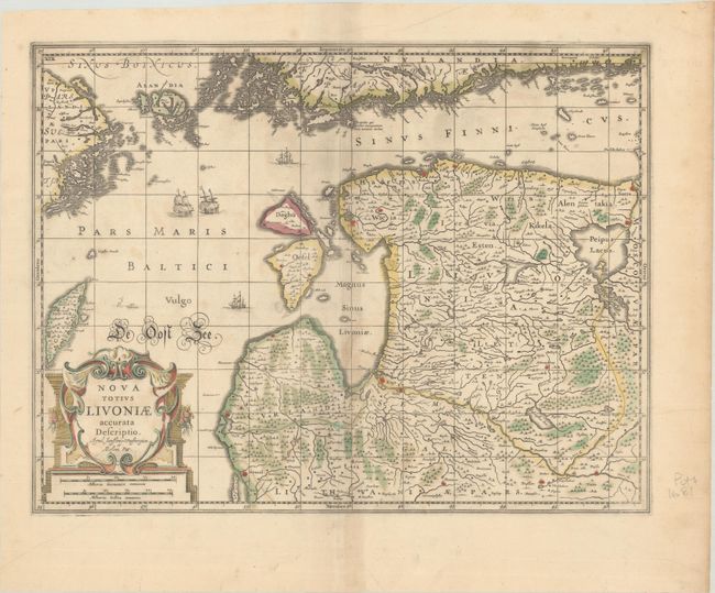
Superb map of Estonia and Latvia providing good information on the rivers, forests, lakes, islands, and cities. A large title cartouche, sailing ships, a sea monster, and wonderful calligraphy decorate the map. Jan Jansson (1596-1664) was a Dutch cartographer and the son-in-law of Jodocus Hondius. A globe maker, he published an edition of Ptolemy's works in 1617, and he and his brother-in-law, Henricus Hondius, published the Atlas Novus in 1637. At Henricus Hondius' death in 1657, he inherited the Hondius publishing firm. This edition was published by Moses Pitt in The English Atlas, as indicated by the added graticule. Originally Pitt's atlas was intended to be a 12-volume set, but only four volumes were published before Pitt abandoned the project due to debt. Blank verso.
References: Van der Krogt (Vol. I) #1710:1B.1.
Condition: B+
Contemporary color in the map with later color in the title cartouche, on a sheet with a small "P" watermark, some toning along the centerfold, and light foxing.