Subject: Central South America, Peru
Period: 1605 (circa)
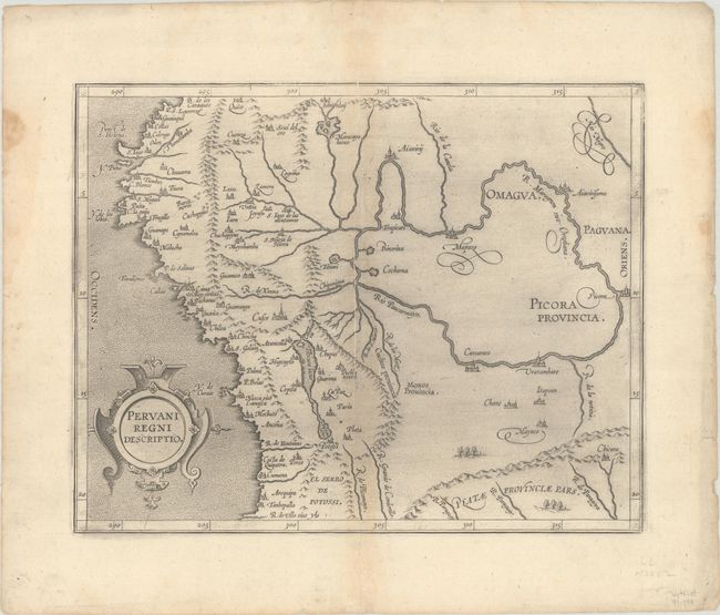
Publication: Descriptionis Ptolemaicae Augmentum
Color: Black & White
Size:
11.2 x 9 inches
28.4 x 22.9 cm
This important early map of Peru is finely engraved with numerous cities located throughout. Lake Titicaca is elongated and joined with Aulaga Lake. The map is embellished with a large strapwork title cartouche and a stipple engraved sea. This is the second state of the map, with the date removed from the title cartouche. The first state appeared in Wytfliet's Descriptionis Ptolemaicae Augmentum… in 1597, which is considered the earliest atlas to focus on the Americas.
References: Mickwitz & Miekkavaara #309-6.
Condition: B+
A dark impression on a sheet with a crowned "B" watermark, some printer's ink residue, a printer's crease adjacent to the centerfold, and minor toning along the centerfold. There are some repaired worm tracks at bottom, a repaired tear at top, and damp stains, all confined to the edges of the sheet.