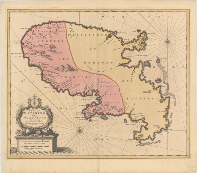
Subject: Martinique
Period: 1685 (circa)
Publication:
Color: Hand Color
Size:
21.9 x 18 inches
55.6 x 45.7 cm
This handsome map of Martinique shows the island divided into two parts denoting the western region occupied by the French and the eastern region labeled Cabesterre (dwelling of the savages). There is good coastal detail in the west but little information presented for the eastern Sauvages part of the island. The remarkable title cartouche features floral wreaths, a compass rose and fleur-de-lis above a large monument-style base that includes the mileage scale. The map is embellished with a fancy compass rose and interesting rhumb lines that use a dotted pattern in addition to the normally seen ruled line.
References:
Condition: B+
A sharp impression with full contemporary color on a bright sheet with marginal soiling and archival repairs to a short centerfold separation at bottom and to a small crack caused by the oxidation of the green pigment. Both of the tiny green islands have been archivally backed to prevent any future cracking.