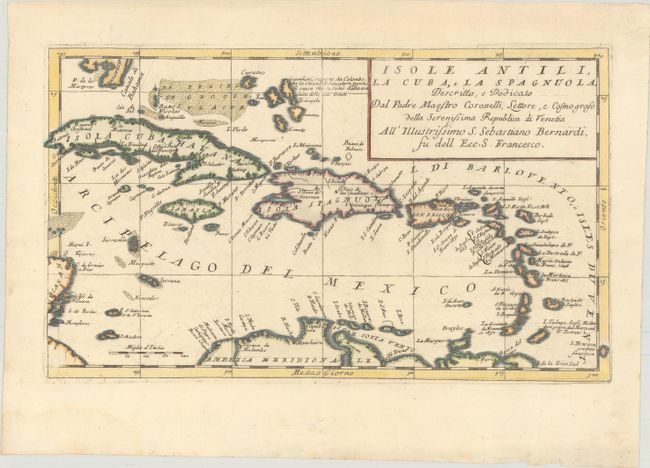
Subject: Caribbean
Period: 1696 (circa)
Publication: Atlante Veneto
Color: Hand Color
Size:
17 x 10 inches
43.2 x 25.4 cm
Coronelli's scarce map of the Caribbean extends from the southern tip of Florida and the Canale di Bahama to the easternmost Antilles and Trinidad. The detailed map is centered on Hispaniola and includes several smaller islands such as the Caymans, Virgin Islands and several islands off the Yucatan Peninsula. A note in the Lucayan archipelago of the Bahamas, identifies Guanahani, the native name for the island where Columbus supposedly landed in 1492 and subsequently called San Salvador.
References: Shirley (BL Atlases) T.CORO-13a #214.
Condition: A
A sharp impression on a bright sheet with wide margins and three minute worm holes just below title cartouche, only visible when held to light.