Subject: United States & Mexico, Texas
Period: 1852-64 (circa)
Publication:
Color:
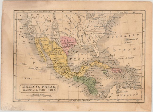
A. Mexico, Texas, Guatimala & West Indies, by G.W. Boynton, published 1852, hand color (6.2 x 4.3"). This small map of the United States, Mexico, Central America, and the Caribbean features a prominent Independent Republic of Texas. It was published in The First Book of History, Combined with Geography; Containing the History and Geography of the Western Hemisphere. For the Use of Schools... by Samuel Griswold Goodrich, writing under the pseudonym Peter Parley. The map names St. Augustine, Liberty, San Jacinto, Austin, Houston, Bexar, Goliad, and Galveston within Texas. Mormon City is located just south of the Great Salt Lake. Condition: The map is lightly toned with some light dampstaining and soiling. (B)
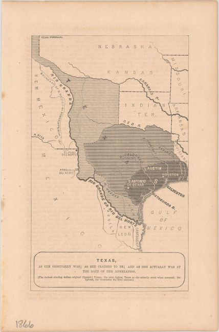
B. Texas, as She Originally Was; as She Claimed to Be; and as She Actually Was at the Date of Her Annexation, by Horace Greeley, from The American Conflict..., circa 1864, black & white (4.5 x 7.3"). This small annexation map features three Texases for the price of one: Spanish Texas, Texas as it was annexed to the United States in 1845, and the claimed territory, extending the length of the Rio Grande north to present-day Colorado. It was published in The American Conflict: A History of the Great Rebellion in the United States of America..., by Horace Greeley, the founder and editor of the New-York Tribune. Condition: Lightly toned with minor offsetting from an opposing page of text and remnants of hinge tape on verso. (B+)
References:
Condition:
See description above.