Subject: Mount Rainier, Washington
Period: 1908-23 (dated)
Publication:
Color: Printed Color
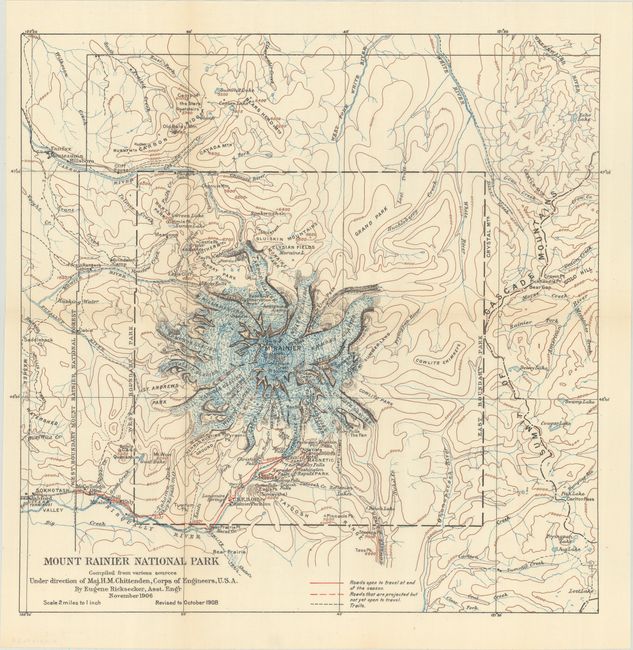
A. Mount Rainier National Park Compiled from Various Sources Under Direction of Maj. H.M. Chittenden, Corps of Engineers, U.S.A., by Eugene Ricksecker, dated 1908 (15.0 x 14.9"). An early map of Mount Rainer Park that was drawn by Eugene Ricksecker under the direction of Major H.M. Chittenden, Corps of Engineers. It depicts the numerous glaciers surrounding Mount Rainer including Emmons, Nisqually, and Tahoma to name a few. Includes good detail of open roads, projected roads, trails, numerous falls, and park hotel. Elevation is represented by contour lines. Originally issued in November 1906 and revised to October 1908. Mount Rainer was the fourth National Park in the United States, created in 1899. In 1908, park visitation was less than 3,000 for the year.
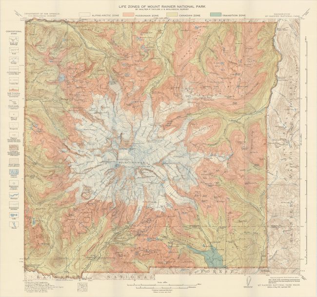
B. Life Zones of Mount Rainier National Park, by Walter P. Taylor, dated 1923 (20.1 x 18.7"). This highly detailed map is color-coded to show the various "life zones" around Mount Rainer including the Alpine-Arctic, Hudsonian, Canadian, and Transition zones. This concept was introduced in 1889 by C. Hart Merriam and was intended to classify regions with similar plants and animals. A legend flanking the map at left reveal additional details including roads, trails, mines, glaciers, streams and more. First issued in 1915 and updated here to 1923.
References:
Condition: A+
Fine, issued folding.