Subject: Texas, Geology
Period: 1937 (dated)
Publication:
Color: Printed Color
Size:
51 x 80.5 inches
129.5 x 204.5 cm
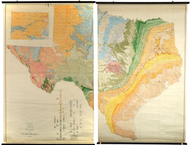
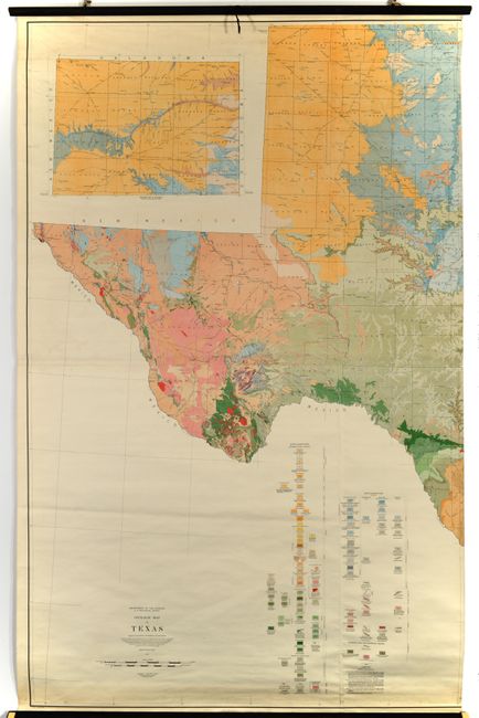
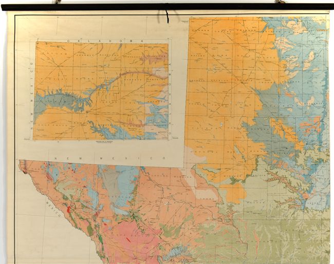
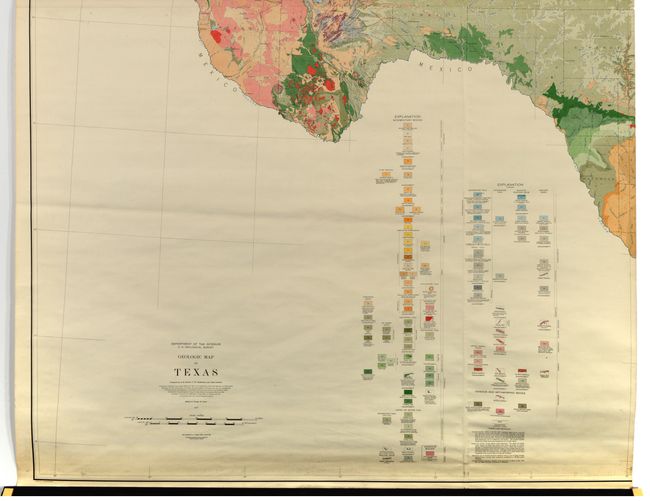
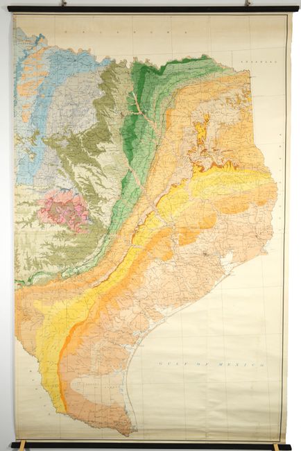
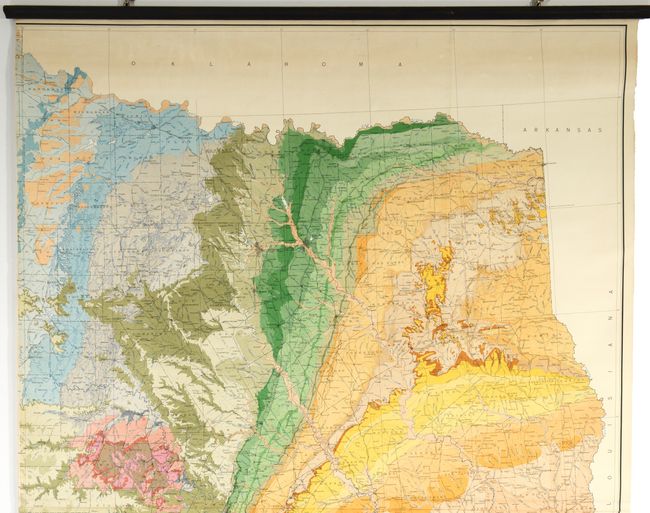
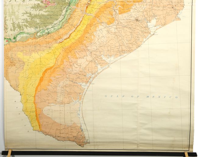
This colossal geological map of the state measures approximately 8.5 feet wide by 6.5 tall if joined together. It was prepared by N.H. Darton, L.W. Stephenson, and Julia Gardner and edited by George Stose. Geological data was compiled over an 11-year period (1924-35) and provided by the University of Texas, the geologists of Texas, U.S. Geological Survey, and various oil companies. Texas led the country in oil production at this time, so it is no surprise that the private sector had some influence on this compilation. The resulting map presents incredible visual detail throughout using a combination of color and pattern, identifying 104 unique types on the map including sandstone, shale, limestone, and granite to name a few. These types are grouped chronologically, spanning from the earliest Precambrian period to the Pleistocene (Ice Age) period. The base map by A.F. Hassan, updated to 1930, provides additional detail including railroads, cities and towns, rivers, parks, and more. An inset at top shows the northern panhandle on the same scale. Printed on four sheets and joined into two vertical sections, with each section linen-backed and mounted on rollers. While we found a few dealer listings and a number of institutional holdings per OCLC, this map has never before appeared at auction.
References:
Condition: A
Colorful examples on bright sheets with some minor surface soiling. Professionally backed with linen and mounted on rollers.