Subject: Minnesota
Period: 1867 (dated)
Publication:
Color: Hand Color
Size:
11.6 x 14.1 inches
29.5 x 35.8 cm
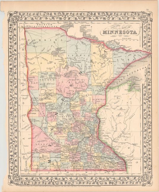
This very detailed map identifies counties, important cities, rivers, lakes, roads, and railroad lines. Development is quite dense in the lower half of the state, tapering off to virtual wilderness in the north. A tangled web of named railroads, both completed and proposed, fill the lower half with a proposed railroad running along the western boundary all the way to the St. Vincent near the Canadian border. Although dated 1867 this map is not completely up-to-date with the county development that was rapidly changing during this period. County configurations are circa 1863, prior to the formation of Beltrami County in 1866. Surrounded in a lovely grapevine border.
References:
Condition: A
Contemporary color on a bright sheet with light toning along the edges and a narrow left margin where the sheet was removed from the atlas.