Subject: Illinois
Period: 1861 (dated)
Publication:
Color: Hand Color
Size:
12.2 x 20.3 inches
31 x 51.6 cm
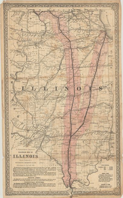
This scarce, separately issued map was created to promote the sale of land along the Illinois Central Railroad. The railroad is boldly marked and surrounding lands are highlighted in pink. The text at bottom gives numerous reasons for settlers to buy land in Illinois: the greatest agricultural resources in the United States, low state debt that would be paid off within 10 years, an extensive railroad system that is privately funded and therefore allows low state taxes, and a well supported school fund. The Illinois Central Railroad was chartered in 1851 and was the first land grant railroad in the United States. The railroad was completed in 1856 and extended from the northern boundary of the state to the southern boundary, making it the longest railroad line in the world at the time. Selling land parcels along the rail line was necessary to repay the investors who had provided the initial funding for the construction of the railroad.
References:
Condition: B
Contemporary hand color, issued folding on thin banknote paper with light foxing, some toning in the top and bottom borders, and several tiny chips and tears along the edges of the sheet.