Subject: Hollywood, California
Period: 1935 (dated)
Publication:
Color: Black & White
Size:
28 x 17.3 inches
71.1 x 43.9 cm
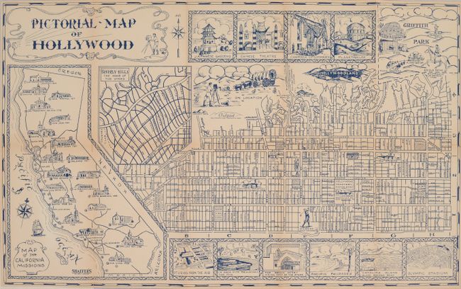
This street map of Hollywood covers the area between Beverly Boulevard to just south of the Hollywood Hills, and from La Cienega Boulevard to North Virgil Avenue. An inset details the streets in Beverly Hills - "the home of the stars." A larger inset maps the 21 Spanish missions in California with miniature views of each building. The map is surrounded by vignettes of popular sites in the area, such as the Chinese Theater, La Brea tar pits, Griffith Park, and the Olympic Stadium (LA Memorial Coliseum), as well as a few further jaunts, including Pacific Palisades and Catalina Island. The importance of the film industry is not forgotten, with a filmmaker and a reel of film encircling the title, another filmmaker shooting a western "on location," and the locations of several movie studios noted on the map.
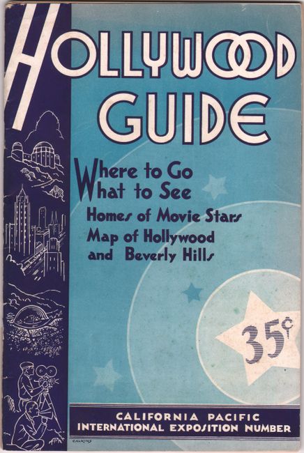
The map folds into a 32-page guidebook that was created for the California Pacific International Exposition, held in San Diego in 1935, to encourage travelers to head north and visit Hollywood, Beverly Hills and the "homes of movie stars." The guidebook includes: an alphabetical directory of stars and their home addresses; a directory of businesses in Hollywood; photos of hotels, tourist attractions and movie-making; and a small map of the California Pacific International Exposition. This information-packed booklet lists a price of 35 cents on the pictorial front cover, which was printed in color. Published by S & D Publishers in Hollywood, which was established by George H. Shaefer and Robert H. De Grange. Although the folding map is not signed by the artist, it was likely created by W. Calkins, who is credited with the artwork on the front cover and created other maps of the region.
References:
Condition: B+
The folding map has a few short separations and minor toning. The booklet is lightly toned and the paper covers are lightly foxed and nearly detached.