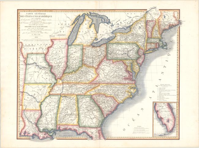
Subject: Eastern United States
Period: 1834 (dated)
Publication:
Color: Hand Color
Size:
23.2 x 18.8 inches
58.9 x 47.8 cm
This scarce map of the eastern United States was published in Guillaume Tell-Poussin's Travaux D'Ameliorations Interieures Projetes Ou Executes Par Le Gouvernment General Des Etats. Poussin spent 17 years in the United States and worked on a number of military projects as a topographical engineer, and it was through these labors that he became an expert in American internal improvements. He published this work upon his return to France and advocated for the American system in France. Cartographically, the map extends to the Texas border with Michigan Territory comprising both Wisconsin and Michigan. Present-day Iowa is named Territoire D'Oregon. The map is filled with details including roads, railroads, canals, towns and villages, hostels, the location of Indian Tribes, and more. Features an inset of southern Florida at bottom right.
References:
Condition: B+
On a bright sheet with some light scattered foxing and a short edge tear at top that just passes the border that has been closed on verso with old paper. A short centerfold separation confined to the bottom blank margin has also been archivally repaired on verso.