Subject: Eastern United States
Period: 1833 (dated)
Publication:
Color: Hand Color
Size:
21.1 x 17.2 inches
53.6 x 43.7 cm
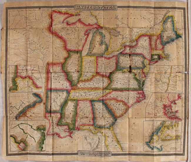
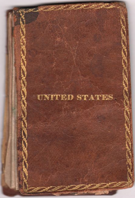
This pocket map of the eastern United States is one of the earliest published by J.H. Colton & Company. It extends beyond the Mississippi River to include the states of Louisiana, Arkansas, and Missouri, as well as the large Missouri Territory that extends from Wisconsin Territory west to beyond the 103rd meridian. The map locates numerous towns and settlements, wagon roads, and features particularly good detail of the river systems. Several canals are identified including the Erie and Chesapeake & Ohio, and a few railroads appear including one from Augusta, Georgia to Charleston, South Carolina. Surrounded by 7 inset maps including Cincinnati, Philadelphia, Baltimore/Washington, South Part of Florida, New York, Boston, and Albany. Engraved by S. Stiles in New York. Folds into brown leather boards (3.4 x 5.5").
References:
Condition: C+
Issued folding with toning, minor foxing, and a 1" fold separation at right. There are two small areas of loss along a vertical fold at right impacting mostly Pennsylvania and Maryland. Covers are worn with the front cover detached.