Subject: Eastern United States
Period: 1795 (circa)
Publication: A New Geographical, Historical, and Commercial Grammar...
Color: Hand Color
Size:
7.9 x 7.2 inches
20.1 x 18.3 cm
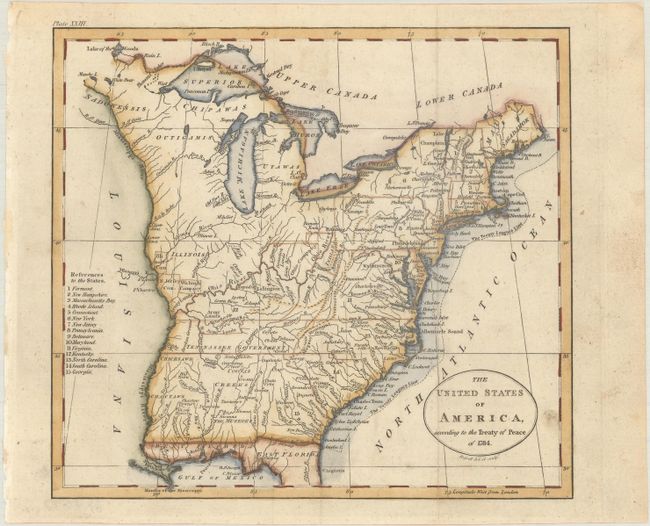
This early map depicts the young United States following the ratification of the Treaty of Paris. The region west of the Mississippi River is completely blank with no features, but good detail is provided along its eastern side locating several named Indian villages and Revolutionary War bounty land grants including those of the Illinois Company, New Jersey Company, Wabash Company, and several Army Lands. In the far northeast the territory of Sagahadok is a large region above the barely mentioned Main. In the south, the northern portion of Florida is depicted and divided into East Florida and West Florida. At the conclusion of the war, control of Florida was returned to Spain. There is good detail of the river systems, towns and villages, forts, Indian lands, and more. Engraved by John Russell. This map was published in the 1795, 1796 and 1798 editions of Guthrie's Grammar.
References: McCorkle (18th C. Geography Books) #172-22.
Condition: A
Issued folding with a few minor spots.