Subject: North America
Period: 1835 (circa)
Publication:
Color: Hand Color
Size:
7.9 x 10.1 inches
20.1 x 25.7 cm
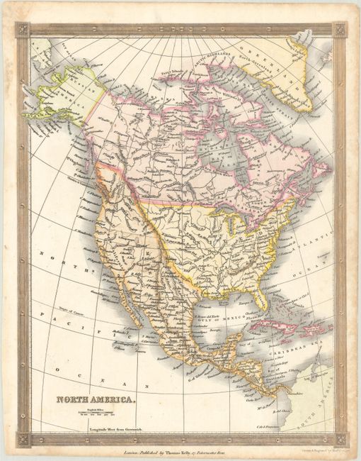
This map shows the United States extending its reach to the Pacific Ocean and north into present-day British Columbia, reflecting U.S. interests in the region (the coloring incorrectly suggests Mexico is in control of the Pacific Northwest - see the engraved line at the 42nd parallel for the correct boundary). Texas is named and part of Mexico though no settlements are noted. In the Great Basin, the rivers San Francisco and Buenaventura are shown running a supposed course to the San Francisco Bay. Surrounded by a decorative border. Drawn and engraved by Alexander Findlay.
References:
Condition: B+
There is some light scattered foxing mostly in the blank margins.