Subject: Fiji
Period: 1827 (published)
Publication: Atlas Universel
Color: Hand Color
Size:
21.7 x 18.5 inches
55.1 x 47 cm
Vandermaelen was the son of a wealthy industrialist who abandoned his father's business to follow a career in cartography. His goal was to produce the first atlas ever published in which every map was drawn on the same projection and to the same scale (1: 1,641,836), with each map covering an area of approximately 20 degrees of longitude (from Paris) and 6 degrees of latitude. Because of the consistent scale and projection, the maps could be joined together to form a huge globe that would measure over 25 feet in diameter. Vandermaelen had the only known globe constructed from his maps, requiring a special room for its display. It was also the first lithographic atlas ever published. There was one edition of the atlas, published in 1825-27, and the subscription list shows that only 810 copies were sold. Koeman called his Atlas Universel, "One of the most remarkable world atlases ever made. Far ahead of its time."
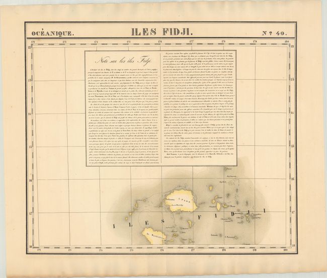
This fine, large-scale map depicts the Fiji islands, focusing on the major islands of Paoo (Vanua Levu) and Naviheelevoo (Viti Levu), here rendered in a somewhat distorted form. Sandal Wood Bay is noted on Vanua Levu; in the 19th century, European traders flocked to Fiji to harvest sandalwood, which was in demand in China. Numerous smaller islands are identified. Much of the sheet is dominated by a large block of descriptive French text describing the islands.
References:
Condition: A
Contemporary color with a couple of spots of foxing and a short centerfold separation confined to the bottom blank margin.