Catalog Archive
Auction 184, Lot 720
"Carte de la Barbarie, Nigritie et de la Guinee avec les Pays Voisins, Dressee sur les Memoires les Plus Nouveaux & les Observations les Plus Exactes", Chatelain, Henry Abraham
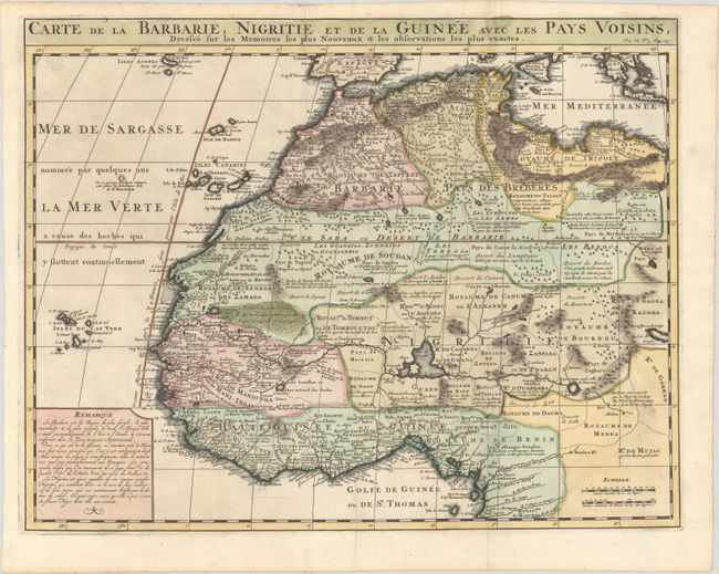
Subject: Northwestern Africa
Period: 1708 (published)
Publication: Atlas Historique
Color: Hand Color
Size:
20.2 x 15.8 inches
51.3 x 40.1 cm
Download High Resolution Image
(or just click on image to launch the Zoom viewer)
(or just click on image to launch the Zoom viewer)