Subject: Moluccas
Period: 1601-30 (circa)
Publication:
Color: Black & White
This copper engraving is from a remarkable series of publications, illustrating voyages of discovery and travels of exploration to various parts of the world. The project was begun by Theodore de Bry of Frankfurt, in 1590 and was to continue for another 54 years. They became known collectively as the Grands Voyages (to America and the West Indies) and the Petits Voyages (to the Orient and the East Indies). De Bry died after the first six parts of the Grands Voyages were completed. The project was completed initially by his widow and two sons, Johann Theodore de Bry and Johann Israel de Bry, then by Johann Theodore's son-in-law, Matthaus Merian, in 1624.
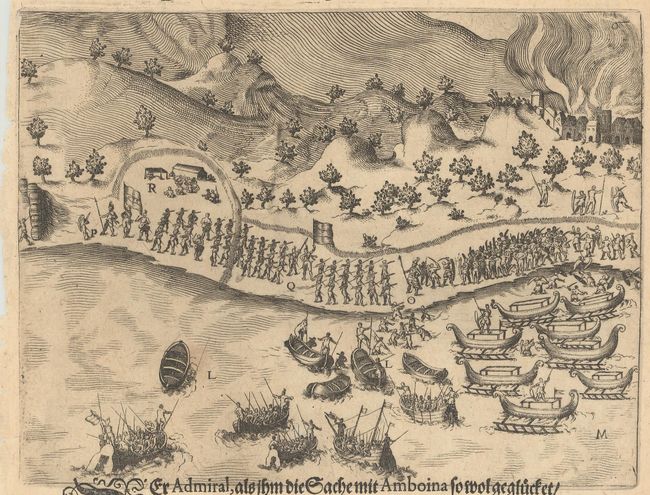
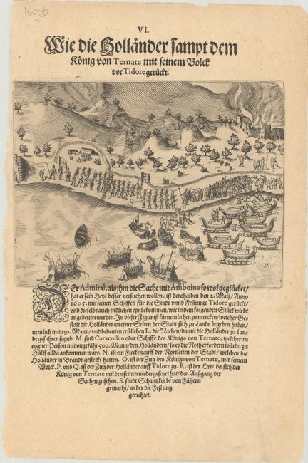
A. [The Dutch Arrive at Tidore, Together with the King of Ternate] Wie die Hollander Sampt dem Konig von Ternate mit Seinem Volck vor Tidore Geruckt, from Petits Voyages, Part VIII, circa 1606 (7.0 x 5.3"). This engraving depicts Admiral Jacob Corneliszoon van Neck, the leader of the second Dutch expedition to Indonesia, as he arrives in Tidore on May 2, 1605, with the King of Ternate and a crew of 150 men. On a sheet of German text measuring 7.8 x 11.9". Condition: Minor soiling. (A)
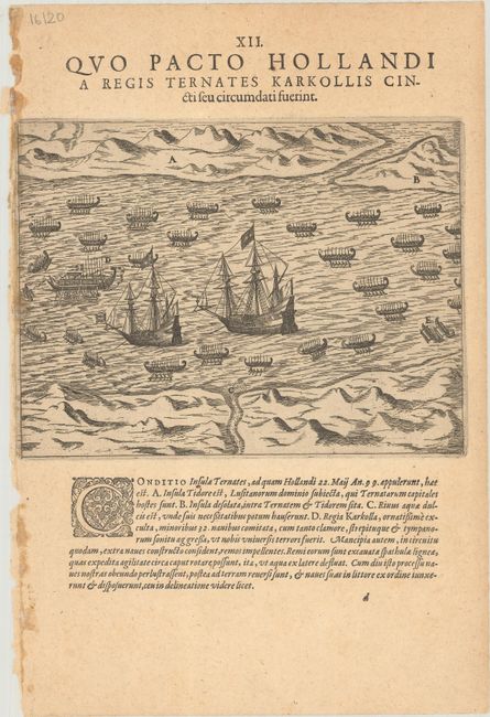
B. [How the Dutch Were Met by the King of Ternate] Quo Pacto Hollandi a Regis Ternates Karkollis Cincti feu Circumdati Fuerint, from Petits Voyages, Part V, circa 1601 (7.2 x 5.4"). This engraving shows Admiral van Neck arriving in Ternate on May 22, 1605. Dutch ships are surrounded by native vessels, including the karkolla of the King of Ternate (here labeled "D"). The shores of neighboring islands appear in the distance. On a sheet of Latin text measuring 7.8 x 11.6". Condition: On a lightly toned sheet with some light soiling at left. (B+)
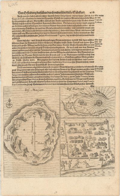
C. [Plan of the Islands of Makian and Bacan] Ins: Macjan [on sheet with] Ins: Baetjan, from Grand Voyages, Part XI, circa 1620 (7.5 x 6.0"). This sheet includes two small maps and a plan related to the Spice Islands. At left is a map of the volcanic island of Makian with nice topographical detail, a couple settlements, and soundings and a compass rose in the surrounding ocean. The island of Bacan is shown at top right. It features a small city plan, an exaggerated harbor filled with ships and soundings, and a compass rose that orients north to bottom left. The plan at bottom right zooms in on the city in Bacan, showing its fortifications, natives, ruins, and more. On a sheet of German text measuring 8.1 x 13.1". Condition: There is minor toning with a small printer's crease at left. (B+)
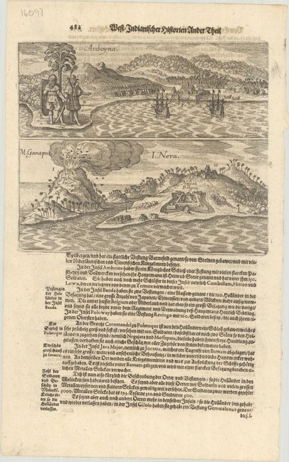
D. [Portrait of the Island Amboina, Together with the Mountain Ganapo and the Island Nera] Amboyna [on sheet with] M. Ganapus / I. Nera, from Newe Welt und Americanische Historien, circa 1655 (7.2 x 6.0"). This sheet features two striking views related to the Spice Islands. At top is a view of Ambon Island, which was the headquarters of the Dutch East India Company from 1610 to 1619. Below is a view of Banda Neira with Fort Belgica prominently depicted. Fort Belgica was built in 1611 to protect Dutch holdings in Banda, the only place in the world where nutmeg was produced at that time. A volcanic eruption is underway at left. On a sheet of German text measuring 8.0 x 13.1". Condition: A nice impression. (A)
References:
Condition:
See description above.