Catalog Archive
Auction 184, Lot 685

"Archipel des Indes Orientales, qui Comprend les Isles de la Sonde, Moluques et Philippines, Tirees des Cartes du Neptune Oriental", Robert de Vaugondy, Gilles

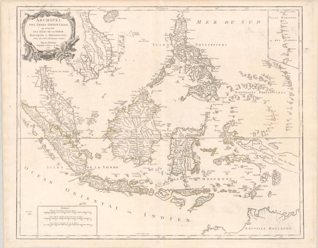
Subject: East Indies - Indonesia

Period: 1750 (dated)

Publication: Atlas Universel

Color: Hand Color

Size:
23.4 x 18.9 inches
59.4 x 48 cm
Download High Resolution Image
(or just click on image to launch the Zoom viewer)

A detailed depiction of the region centered on Borneo, showing Sumatra, Java, the Malay Peninsula, the Philippines, and the tips of New Guinea and Northern Australia (Nouvelle Hollande). An inset at upper right depicts the Marianas. The map names Sincapoura (Singapore) and Batavia (Jakarta) and locates the important Spice Islands. A decorative rococo-style title cartouche and three distance scales are also featured. Engraved by Guillaume Delahaye.

References: Pedley #413.

Condition: A

Contemporary outline color on a bright sheet of watermarked paper with a bit of printer's ink residue.

Estimate: $450 - $550

Sold for: $325

Closed on 9/15/2021

Archived