Subject: Asia
Period: 1752-80 (circa)
Publication:
Color:
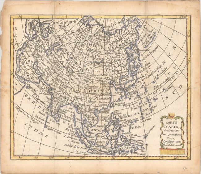
A. Carte d'Asie, Divisee en ses Principaux Etats, Assujettie aux Observs. Astronoms., by Joseph de Laporte, from Atlas Moderne Portatif..., circa 1780, hand color (8.8 x 7.0"). This handsome small map of the continent features plenty of place names and nice topographical detail. I. de Yeco is depicted as an island. There is a vague area named Terre de la Compagnie to the southeast of the Kamchatka Peninsula. A note along a stretch of coastline in the present-day Bering Sea credits the discoveries of Aleksei Chirikov and Joseph Nicolas Delisle in 1741. Condition: Issued folding, now flat, with light toning and foxing that is mostly confined to the margins. (B+)
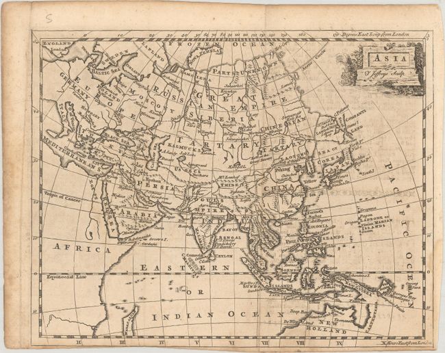
B. Asia, by Thomas Jefferys, circa 1752, black & white (9.1 x 7.2"). This small map of Asia shows the extent of knowledge that is typical for this time period, and extends all the way to London to give British readers a perspective on how far various Asian countries are. The Land of Jesso (Hokkaido) appears as an island, although its western coastline is ambiguous. To its east is a partial landmass named Companys Land. The coastlines of New Guinea and Carpentaria (Cape York Peninsula) are left incomplete, suggesting that they may be connected. The map is adorned with a decorative cartouche at top right. Condition: Issued folding on a sheet with a fleur-de-lis watermark. There is light offsetting from an opposing page of text and the margin is trimmed close to the neatline at bottom. Minor soiling. (B)
References:
Condition:
See description above.