Subject: Red Sea
Period: 1781 (dated)
Publication:
Color: Black & White
Size:
26.9 x 19.5 inches
68.3 x 49.5 cm
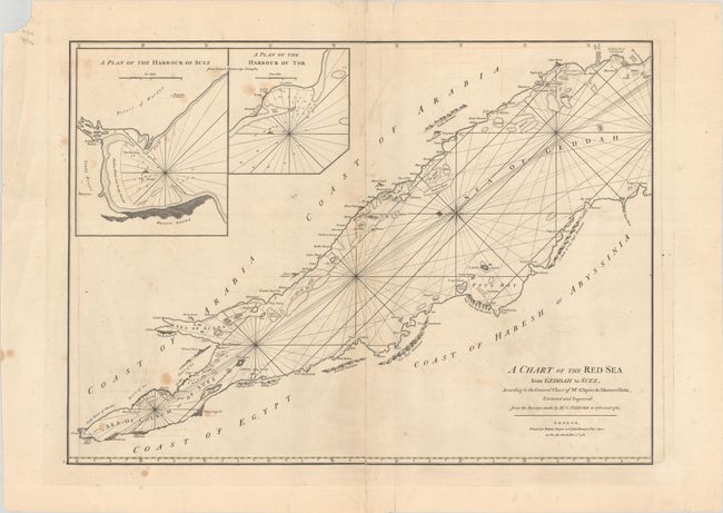
This uncommon chart covers the Red Sea from Mecca to the Gulf of Suez. It is based on Jean B. N. D. Apres de Mannevillette's chart, originally published in Neptune Oriental in 1745, and incorporates new information from the 1762-63 surveys of explorer and cartographer Carsten Niebuhr. The sea is crisscrossed with rhumblines and includes soundings, anchorages, and other navigational information. On land, there are place names and some topographical detail, with an emphasis on coastal mountains. Mount Sinai is located east of El Tor and the Desert of Sin. There are two inset plans at top left that zoom in on the harbors of Suez and El Tor. This is the second edition of this map published by Sayer & Bennett; it was later reissued by Laurie & Whittle.
References:
Condition: B
There are light stains, offsetting, and several edge tears, including one that enters the map image at top. A vertical separation that runs the length of the map has been repaired on verso with old paper.