Catalog Archive
Auction 184, Lot 622

"Carte de la Partie Septentrionale de l Empire Otoman Contenant la Crimee, la Moldavie, la Valakie, la Bulgarie, avec la Nouvelle Russie, les Gouvernement d'Astracan, et de Voronez, les Tatares Cosaques &", Rizzi-Zannoni, Giovanni Antonio

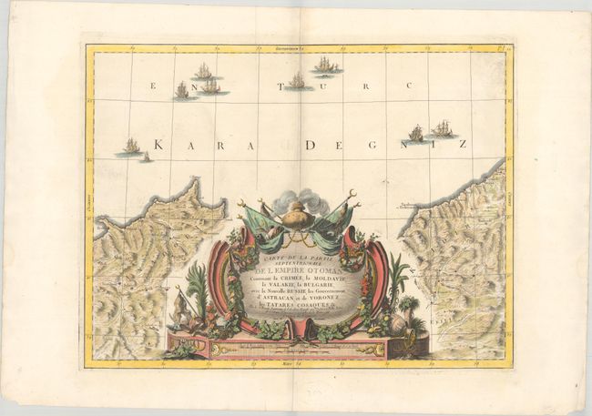
Subject: Northern Turkey

Period: 1774 (dated)

Publication:

Color: Hand Color

Size:
22 x 16.7 inches
55.9 x 42.4 cm
Download High Resolution Image
(or just click on image to launch the Zoom viewer)

This is the title sheet of a six-sheet map of the Ottoman Empire in Europe and shows the northern coast of Turkey along the Black Sea, extending from Eregli in the west to Batumi in the east. There is excellent topographical detail, and a number of towns, cities, and rivers are shown. The Black Sea is filled with sailing vessels and the sheet is dominated by a massive decorative title cartouche.

References:

Condition: A

A sharp impression on a bright sheet with minor marginal soiling and a few faint dampstains along the edges of the sheet.

Estimate: $275 - $350

Sold for: $200

Closed on 9/15/2021

Archived