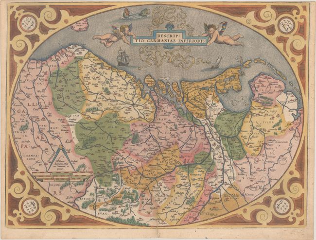
Subject: Low Countries
Period: 1575 (published)
Publication: Theatrum Orbis Terrarum
Color: Hand Color
Size:
19.8 x 14.9 inches
50.3 x 37.8 cm
This highly decorative map of The Netherlands, Belgium and Luxembourg is presented in an oval strapwork border with the cardinal directions enclosed in roundels in the corners. The map is filled with detail of the rivers, villages and towns, forest and marshes. Putti hold the title cartouche aloft with ships and a sea monster embellishing the North Sea. Latin text on verso.
References: Van den Broecke #58.
Condition: B+
A nice impression on a sturdy sheet with the crossed arrows watermark commonly found on Ortelius maps. There is minor soiling and an archivally repaired centerfold separation that enters 1.5" into image at bottom. Trimmed to neatline at top by bookbinder.