Subject: Europe, World War II
Period: 1942 (dated)
Publication:
Color: Printed Color
Size:
39.3 x 28.5 inches
99.8 x 72.4 cm
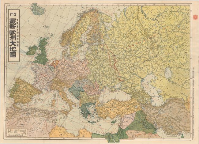
This richly detailed Japanese map was published by Osaka Mainichi Shimbun Newspaper, Inc. during World War II. It covers all of Europe and extends east to Turkey, the Caucasus, Syria, Iraq, Iran, and part of Central Asia. The map focuses on the political boundaries, roads between key cities, and shipping routes in the various seas surrounding Europe. In France, red hatched overprinting indicates the area occupied by the German army based on the Franco-German Armistice on 22 June 1940. In eastern Europe are two additional lines of red overprinting showing the advances of the German army in November 1941 and April 1942. An interesting map that showed the current theater of war in Europe for a Japanese audience.
References:
Condition: A
A bright example, issued folding with minor marginal soiling.